Durmitor: description, attractions, directions
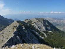
Durmitor is a national Montenegrin reserve, which is located in the northern part of the country. This mountain range is recognized as the largest in the world and has 48 peaks, the height of the largest of which is 2523 meters.
Description
Durmitor National Park is highly popular among tourists in the country. Montenegro announced the creation of the park in 1952, but in fact, the need to protect natural areas was declared by Prince Nicholas I in 1907. Today this area is part of the UNESCO World Heritage Site.
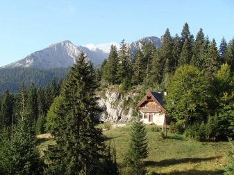
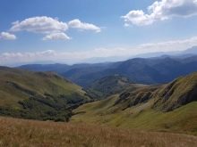
Durmitor is considered a real miracle of nature, since here on a huge territory are located and ancient forests, and mountains, and lakes, and rivers. Along with the natural beauties, ancient villages have survived, in which there are residents who live according to ancient rules and canons. The centuries-old way of life has not changed since ancient times, so an ordinary person who comes here for the first time feels himself in a completely different dimension.
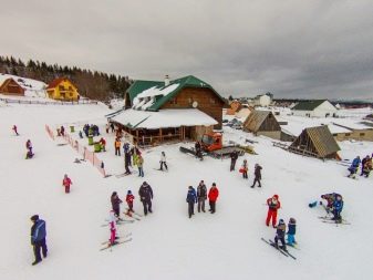
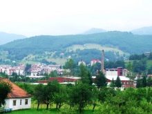
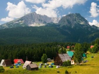
The registered area of the park is 390 square kilometers, and it is located between the cities of Zabljak, Shavnik, Pluzine, Mojkovac, Pljevlja. Expeditions are regularly sent to this natural area. At the same time, locals are just as active in visiting the territory as foreigners. There are a lot of visitors in Durmitor all year round. The park is popular in summer for its natural beauty, and in winter you can rent a snowboard or ski.
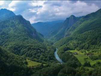
In addition to the mountain range, the Tara, Sushitsa and Draga rivers flow in the park. Beautiful meadows, forests, lakes, numerous mountain streams. For the convenience of tourists, all the infrastructure necessary for travel is concentrated in the city of Zabljak. Almost all excursion routes start here, climbers and hikers start their way from here.
Shavnik is a small town, the smallest in terms of local population... According to the 2003 census, 570 people are registered here. The rivers Bukovitsa, Bele and Shavnik begin in the town, which are chosen by lovers of rafting.
Local meadows and pastures allow residents to actively develop animal husbandry, so those who like to eat natural products also come to the town. The following excursions are organized from the town:
- canyon Nevideo - Komarnitsa;
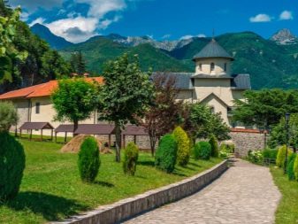
- Bijela monastery;
- Podmalinsko monastery;
- Durmitor National Park;
- Shavnik river.
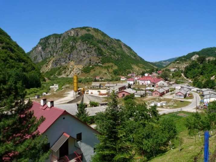
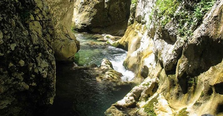
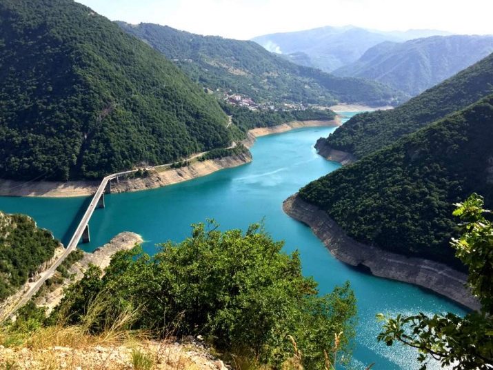
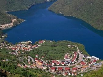
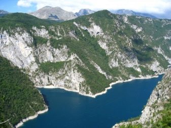
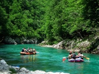
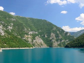
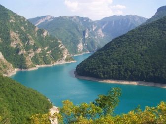
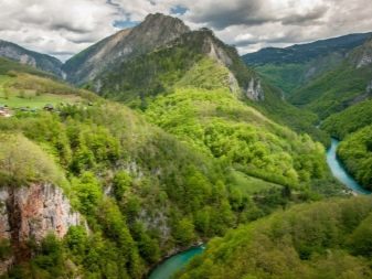
Pluzine is another town with a population of 1,500, famous for its hydroelectric power plant and local reservoir. The settlement was chosen by lovers of outdoor activities, from here rafting on the Tara and Piva rivers begins. Tara is part of the protected area of Durmitor. This river flows between picturesque rocks and falls periodically with waterfalls. The water temperature does not rise above + 15 ° C, it is considered to be drinking. In Europe, it is the largest such waterway, the water from which does not require purification.
Moikovac is another town on the Tara River, and from here there is access to the Sineyavina and Belasitsa mountains. Skiing and rafting are popular activities for tourists who have chosen this town as a stopover.
The surrounding lakes are rich in trout, so lovers of this type of recreation gather here during the fishing season. Among the attractions of the town are:
- the 12th century mint;
- the monastery of St. George;
- Moraca monastery.
Popular hotels where vacationers like to stay:
- Krstac;
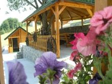
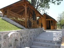
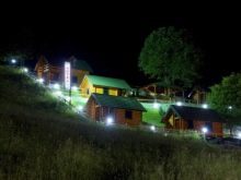
- Palas;
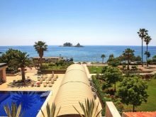
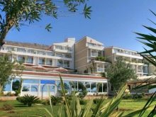
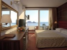
- Tara;
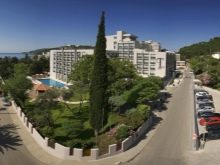
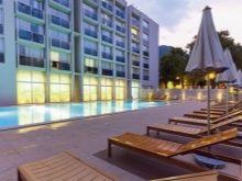
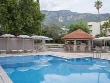
- Lipka;
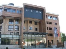
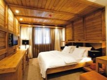
- Bianca.
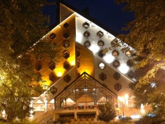
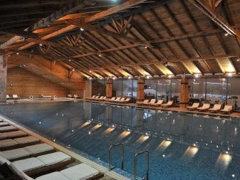
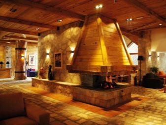
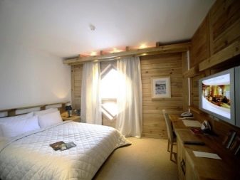
The average room rate is 35 euros per day per person.
Climate
The climatic zone of Durmitor is located to the north of the coastal zone, therefore in May and June it is cooler here than in the main part of the country. The national park also attracts with its coolness. Here you can hide from the heat that haunts Montenegrins during the high season.
It is convenient to track the weather in Durmitor in winter, summer, spring or autumn using a special meteorological table, which includes data for several years. For example, a diagram obtained over the past 30 years will tell you about the typical climatic features of the area. Expected weather conditions that you can easily study yourself:
- temperature;
- precipitation;
- sunshine;
- windiness.
Meteorological charts are available on internet resources such as meteoblue. Data on Durmitor indicate that the maximum temperature here can be in August (up to +22 degrees), and the minimum is possible in January (-5 ° C). At the same time, it can be about -16 ° C at night. It is not particularly windy here: the speed of wind gusts is from 4 to 12 m / s. The greatest amount of precipitation is possible in April, May, and especially cold rains are in November.
The most comfortable average daily temperature can be in September - + 8 ° C, it is at this time that it is especially beautiful in Durmitor.
When planning a vacation, it is recommended take into account the indicators of the average temperature, so you can prepare for all the weather surprises in the area. Considering the schedule of sunny days and precipitation, it can be said that Durmitor is driest in July. Cloudy weather will await tourists who decide to go to the reserve in winter, as well as in March or November.
What to see?
The main attractions of Durmitor:
- walking routes;
- reservoirs and streams;
- ski resort.
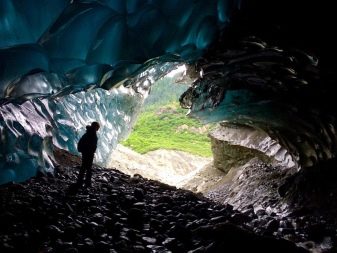
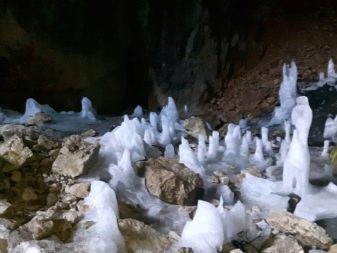
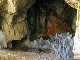
On the territory of the reserve there is an ice cave Ledena pecina. It is located on a hill where only trained tourists can go. The cave is 100 meters long. Its inner surface is dotted with beautiful stalagmites and stalactites. The icy reliefs sparkle and sparkle, and in places resemble fantastic statues.
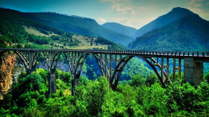
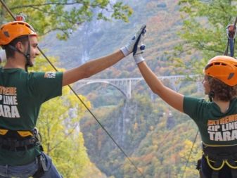
Another famous landmark is Djurdzhevich bridge. It is considered the highest in Europe, as it rises above the surface by about 172 meters, its length is 365 meters. The building was erected at the end of the 30s of the last century.
Until recently, this bridge was the only one that connected the north and south of Montenegro. The building has architectural and historical value. The bridge includes five beautiful arches, under which the vastness of the canyon stretches.
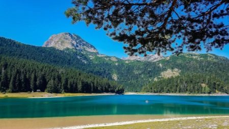
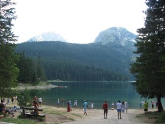
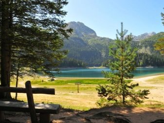
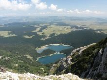
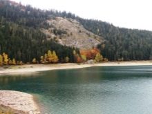
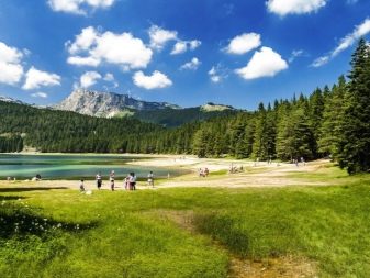
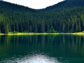
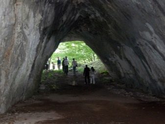
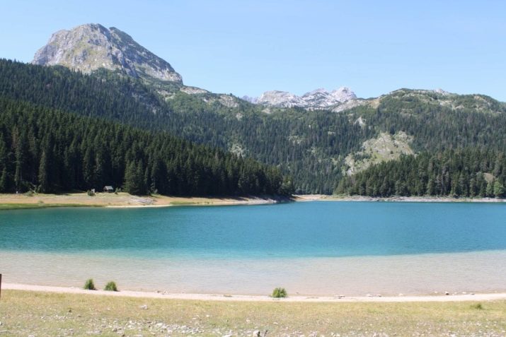
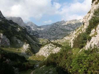
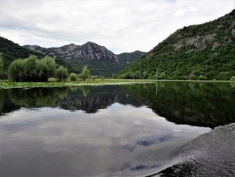
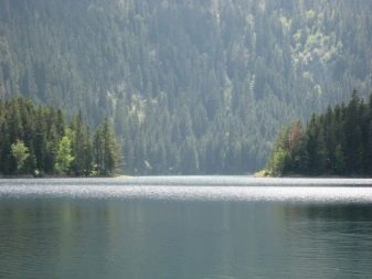
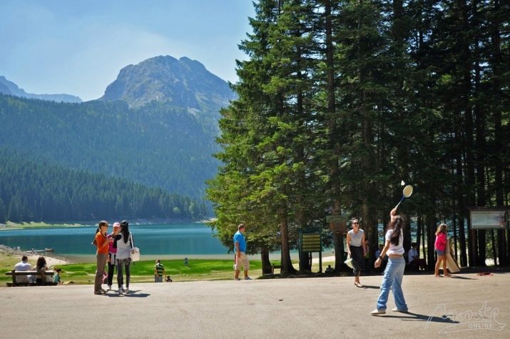
There are many walking trails in the park, the most famous of which is the cycling track that goes to the famous Black Lake. Outwardly, it is emerald green, transparent and visible through and through, to the very bottom. The reservoir got its name from the mountain nearby, which casts a shadow on the water surface.
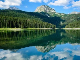
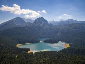
Another lake is connected to the Black Lake, which is called Small (it is significantly inferior to the first in area). In depth, it is deeper, almost twice. The lake exists due to the melting of glaciers, numerous streams descend to it, the largest of which is Mill stream. It differs from the rest by its constancy and fullness. Many other streams disappear before the heat wave comes in August.
Around the lakes there is a hiking trail about 3 km long, which can be walked in two to three hours. Fascinating natural views will open along the way. It is recommended to travel along the route in the early morning, then there will be almost no people on the way.
That said, the sunlight is soft in the morning, so you'll get perfect photos. For the passage to the lake you will have to pay a fee - about 2 euros.
Another curious Lake Durmitor - Pivskoe, it is famous for its purest water and beautiful surroundings.
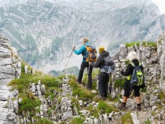
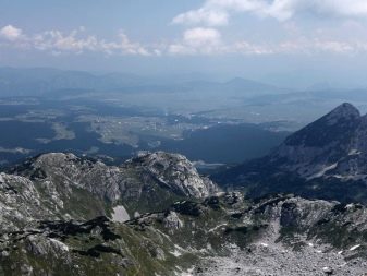
You can contemplate the entire reserve from the highest mountain Bobotov Cook... There are tourist routes laid to the top, but they cannot be called simple. The nature in the mountains is different, and the snow practically does not melt.
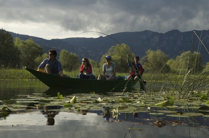
Excursions to the national park cost from 40 euros for an adult and about 20 euros for a child, children up to three years old are free of charge. Popular routes - to Skadar Lake, which is considered the largest in Europe, to the ancient shrine of Moraca.
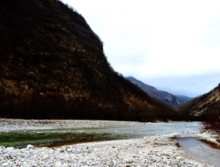
Not less popular canyon of the Tara river. There is a bungee here, there is a restaurant with dishes of national cuisine.
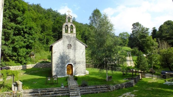
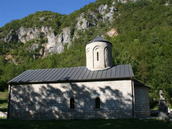
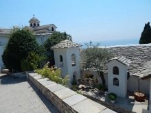
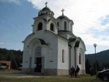
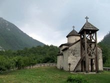
In addition to natural beauty, the park has historical sights. These are the monasteries of the Archangel Michael, Dovolya, Dobrilovin, as well as burial places that date back to the ancient Roman period.
The region is famous for its high ecological level. Walking around the local area is not complete without collecting medicinal herbs and brewing healthy teas. This area is also popular with hunters and fishermen.
How to get there?
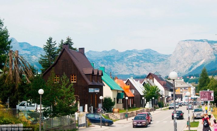
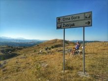
On the map of tourist routes, Durmitor is marked as a mountain park, a place for active recreation. The most convenient way to get to it is from the town of Zabljak (the name translates as "paddling pool"). The town is always full of tourists; in winter, mountain skiing lovers come here, and in summer, fans of hiking and cycling.
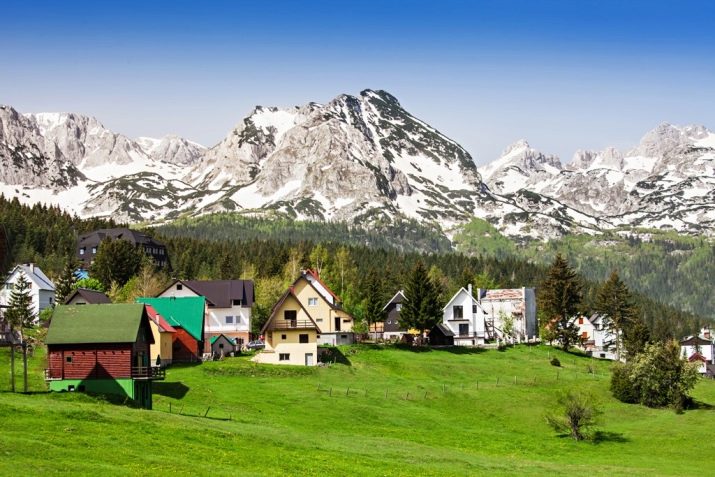
Zabljak can hardly be considered a city by Russian standards, since small private houses here are lined up along one street. The area is clean, accommodation in campsites for a tourist will cost from 25 euros and more. "Razvrshe" is the most popular local "hotel" with cottages for two, with shower and toilet, as well as satellite TV. Rooms and a bed in the private sector are widely rented, so it will be very easy to find a place to stay during your vacation.
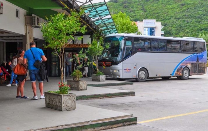
A bus service is organized to the town, for example, from the capital you can get to the place for 7 euros. Only local roads are of poor quality, and the distance from the capital is rather long - more than 120 km. Travel time from the capital is a little over 2 hours.
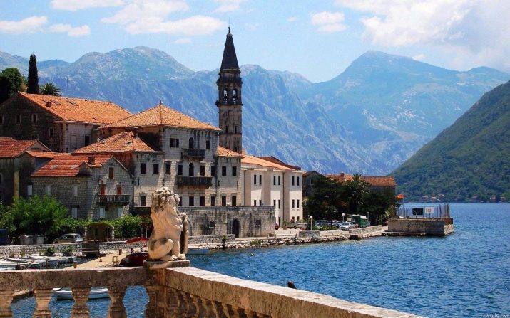
It will take almost three hours to get from the city of Tivat. The road from this resort town is better, the motorway is even included in the European route E65.A two-lane highway stretches along the entire Adriatic coast and connects Budva, Petrovac, Sutomore, Bar and Ulcinj. You can use a rented car for a trip.
The exact distance between Tivat and Zabljak is 177 km. To move, you will need about 15 liters of gasoline, the cost of which is about 18 euros.
If you don't have a car, you can take the bus route from Tivat. At the Tivat Zob stop, you need to get on the bus, paying the carrier about two euros. After driving 10 km, you need to get off at the Kotor stop. This path will take about 20 minutes. At the stopping point, you need to get on a Bozur bus, pay about 15-20 euros and drive to your final destination.
The journey from Kotor to the town of Zabljak will take about four hours. Other popular bus routes:
- Budva - Zabljak;
- Bar - Zabljak;
- Kolashin - Zabljak;
- Petrovac - Zabljak.
There is also a route from Belgrade, the fare will be 22 euros.
In the next video, you can visually familiarize yourself with the Durmitor National Park, the mountains and reservoirs of Montenegro.


